St Marys Books
Telephone: 01780 763033 Email: info@stmarysbooks.com
...or pay a visit to our shop in Stamford, Lincolnshire, UK
Skip navigationBooks > Topography > The Imperial Map Of England And Wales According To The Ordnance Survey, With The Latest Additions; Showing Clearly Every Feature Of The Country Railways And Their Stations
The Imperial Map Of England And Wales According To The Ordnance Survey, With The Latest Additions; Showing Clearly Every Feature Of The Country Railways And Their Stations
John Bartholomew
Ref. 116989
Published By: A. Fullarton & Co. (London)
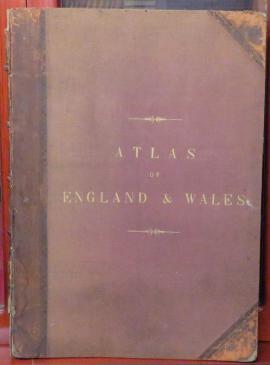
Roads, Canals, Rivers, Gentlemen's Seats &c &c. By John Bartholomew. On a Scale of 4 miles to an inch. No date (1866). Large Folio Size. Original half leather with cloth boards with some discolouration to the boards, rubbing and wear to the leather, some loss to the corners and to the top and base of the spine. There is some cracking to the top half of the outer hinges but the binding is still fairly tight. Gilt titles to the upper board are still clean and bright. The interior hinges have at one time been reinforced with brown tape. There is a vertical crease to the front free endpaper and to the first blank page. With 16 double-page chromolithographic maps of which plate 16 is divided into three separate maps. There is foxing throughout, especially to the index, although with the exception of one map (the Irish Sea) does not affect the rest of the maps too greatly. Each map is tissue-guarded although some are worn and chipped. Overall a good collection of maps from John Bartholomew.
Book Condition: Good
Size: folio
Binding: Half Leather
Book Type: Hardback